
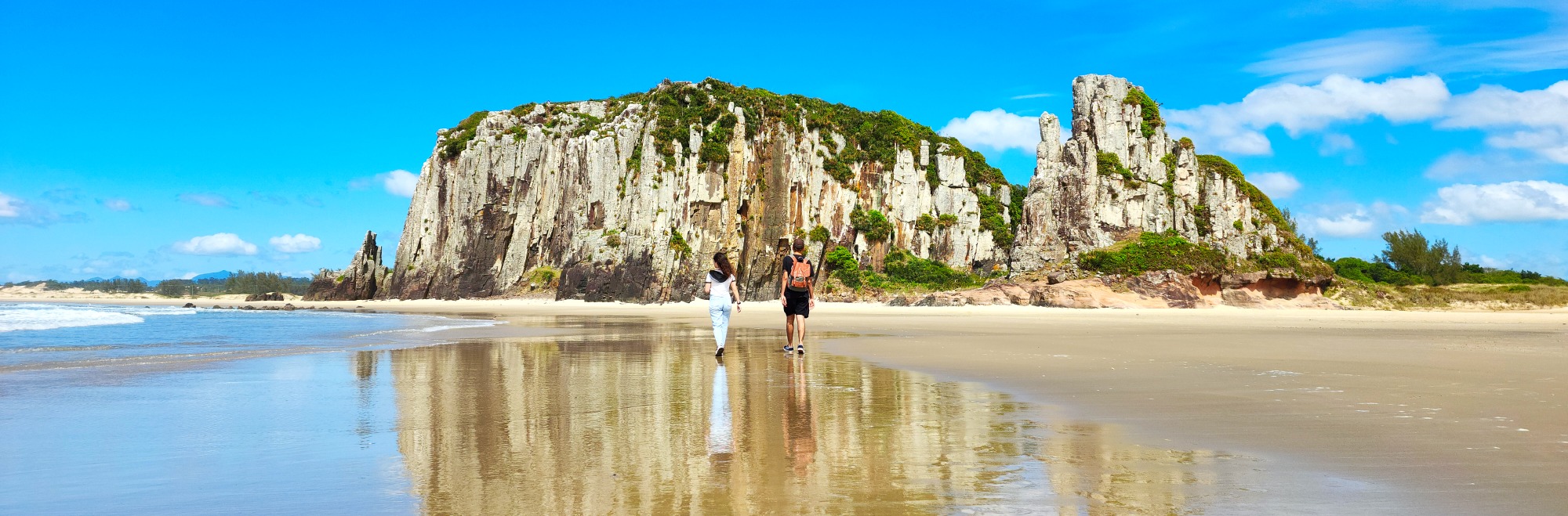
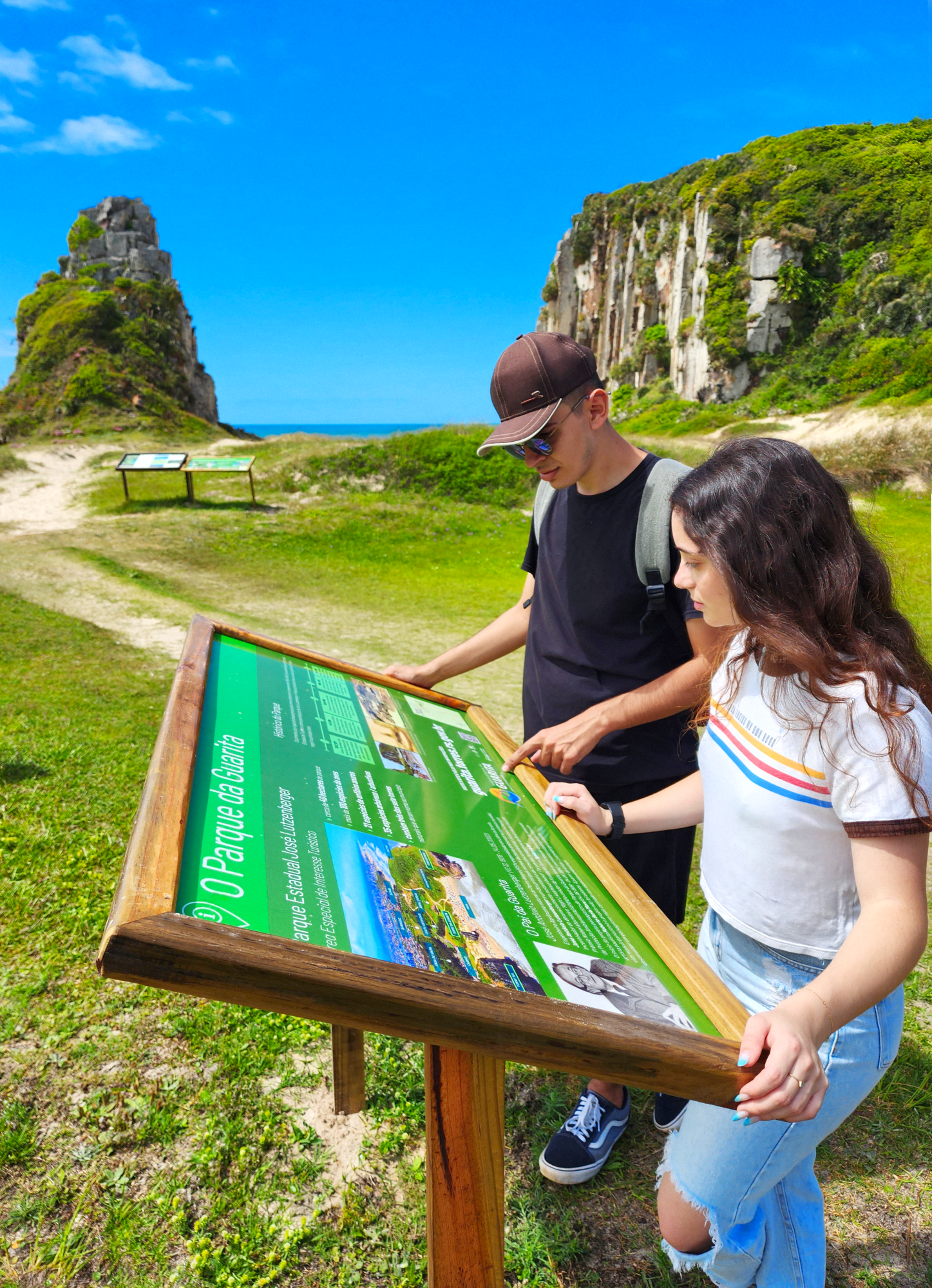
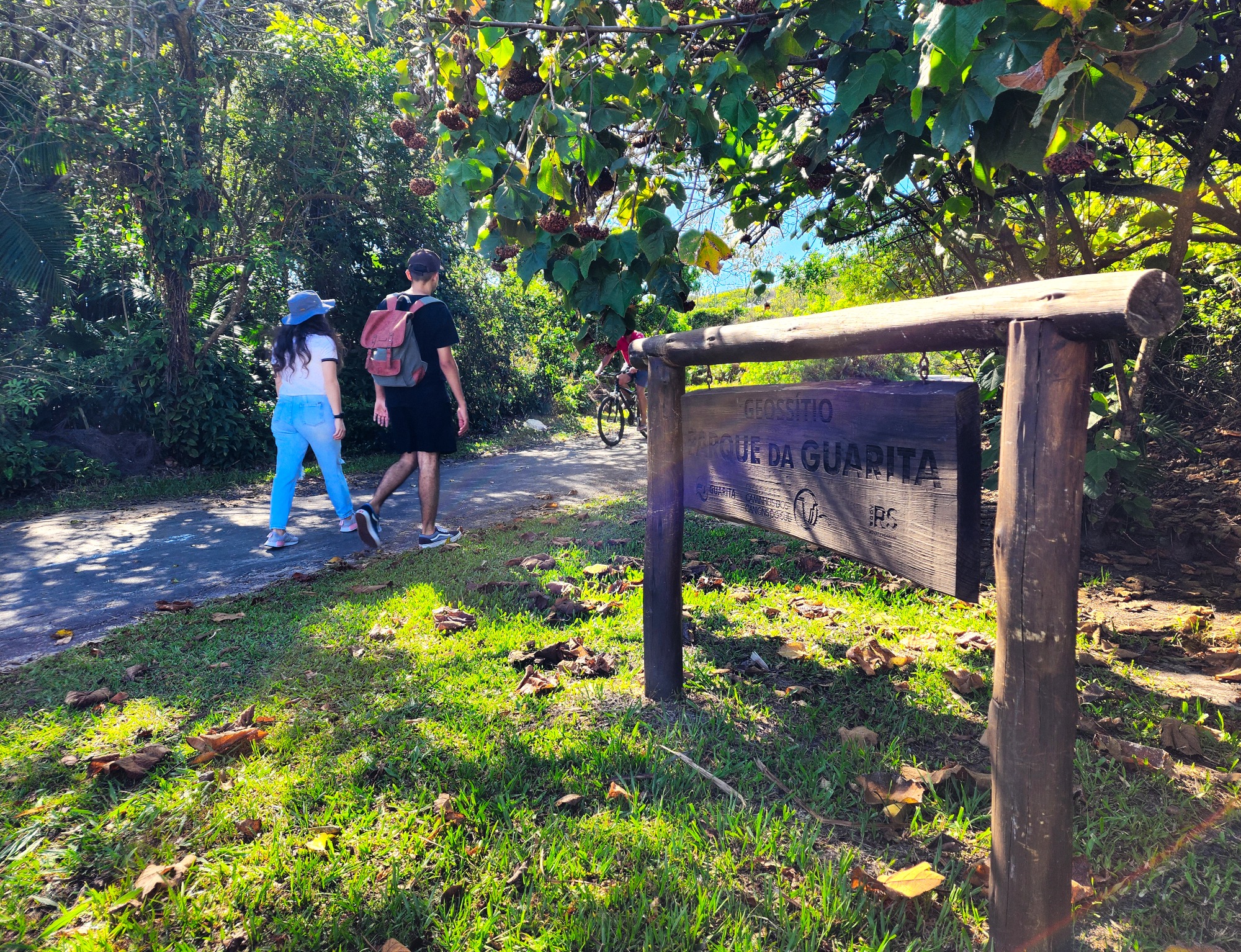
Guarita State Park
Creation of the Park
José Lutzenberger State Park
Special Area of Tourist Interest
- Approximately 40 hectares of park area
- More than 100 bird species
- 21 species of anuran amphibians
- Contains three of the seven natural towers that gave the municipality its name
The Father of Guarita
José Antônio Lutzenberger (Dec 17, 1926 – May 14, 2002)
An agronomist from Porto Alegre (RS), specialized in soil science. José Antônio Lutzenberger is one of the key names in the global environmental movement. A promoter of sustainable development and environmental awareness, he received the Right Livelihood Award (also known as the “Alternative Nobel Prize”) and founded the Gaia Foundation (fgaia.com.br).
The initial landscaping project for the Guarita Park included the participation of the team of the renowned São Paulo artist Roberto Burle Marx (Aug 4, 1909 – Jun 4, 1992). However, since the proposal had a more urbanistic focus, the project was not carried forward. From that point on, Lutzenberger began developing a landscaping plan centered more on environmental aspects.
Park History
The main legal actions for the expropriation of the seaside towers occurred between 1956 and 1968. Under the administration of the State Department of Tourism and with the participation of José Lutzenberger, Guarita Park began to take shape from 1971 onward. Here are the key milestones:
Dec 28, 1971
The area is declared of public interest (State Decree 21.540/1971) for the creation of Guarita Park, with José Lutzenberger as its main visionary.
Oct 14, 1981
The site becomes a Special Area of Tourist Interest (State Decree 30.377/1981) with an area of over 1,000 hectares, including parts of what now belongs to Itapeva State Park.
Sept 9, 1983
Guarita Park has its area reduced to its current size, with just over 40 hectares. A large portion of the previous area became part of Itapeva Park in 2002, and another portion was urbanized, becoming the Guarita/Arroio neighborhood.
1996 to 2002
The park’s management shifted between the State Department of Tourism and, at times, the local City Hall. In 2003, the State officially handed over the park’s administration to the municipality.
Jan 2, 2003
The park is officially renamed José Lutzenberger State Park, in honor of the renowned environmentalist.
UNESCO’s Global Geopark
Caminhos do Cânions do Sul – Territory
Reknown as UNESCO Global Geopark in 2021.
- The geopark is an iniciative aimed at sustainable economic development, having as base the integration and the valorization of natural and cultural heritage of a region.
- Territory: 2.830 Km2
- Member cities:
- RS: Torres, Mampituba and Cambará do Sul.
- SC: Praia Grande, Jacinto Machado, Timbé do Sul and Morro Grande.
Visit the website on canionsdosul.org
Beaches
Praia de Fora
The Praia de Fora with 325,17 m of extension, is one of the smaller beaches of the city. Situated in between the South Tower and Itapeva Beach, it’s the beach more at north of the ones called beaches of the south, in Torres’ coastline. This beach is a great option for people who want a quieter place to swim, but still close to the urban center. In the vicinity of Praia de Fora, there are 3 great natural environments, the Restinga, the Dunes and the Paludosa Forrest.
Other beaches from Torres
From the north limit with the Molhes of the Mampituba River (border with Passo de Torres-SC), until the extreme south (border with Arroio do Sal), the city of Torres have 24 beaches, being the smallest the Beach of Caqueiros (62,75 m) and the biggest the Itapeva Beach (3.828,63 m).
From the Beach of the Molhes to the South Tower, are the beaches that informally make the municipal north coast, characterized for the visual variation, with sandy beaches interspersed with rocky/grassy beaches and hills; and from the South Tower to the Paraíso Beach, we have the municipal south coast, characterized essentially for sandy beaches with homogeneous appearance, except in Itapeva Beach, with the Itapeva Boulder, and in Lagoa Jardim Beach, with the Caracol Monument (a dune in a spiral shape).
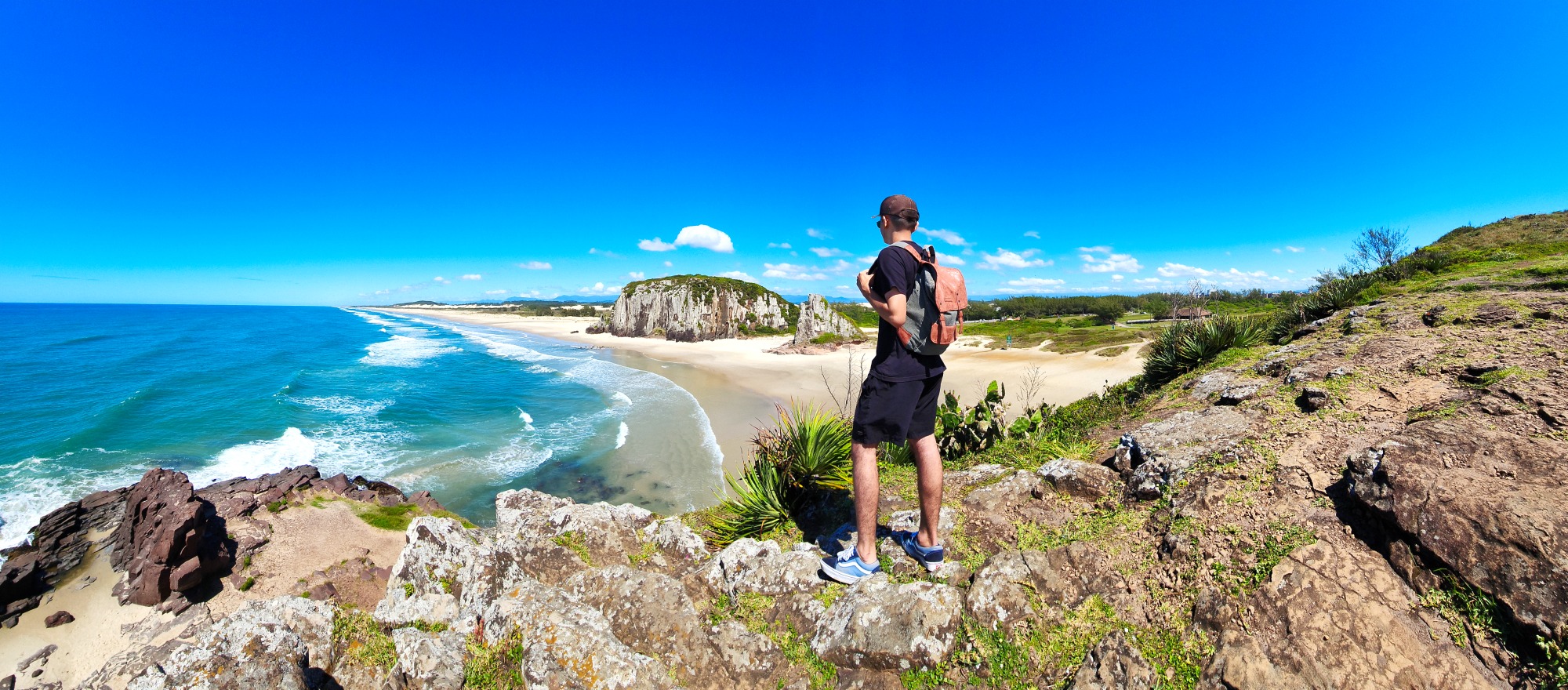
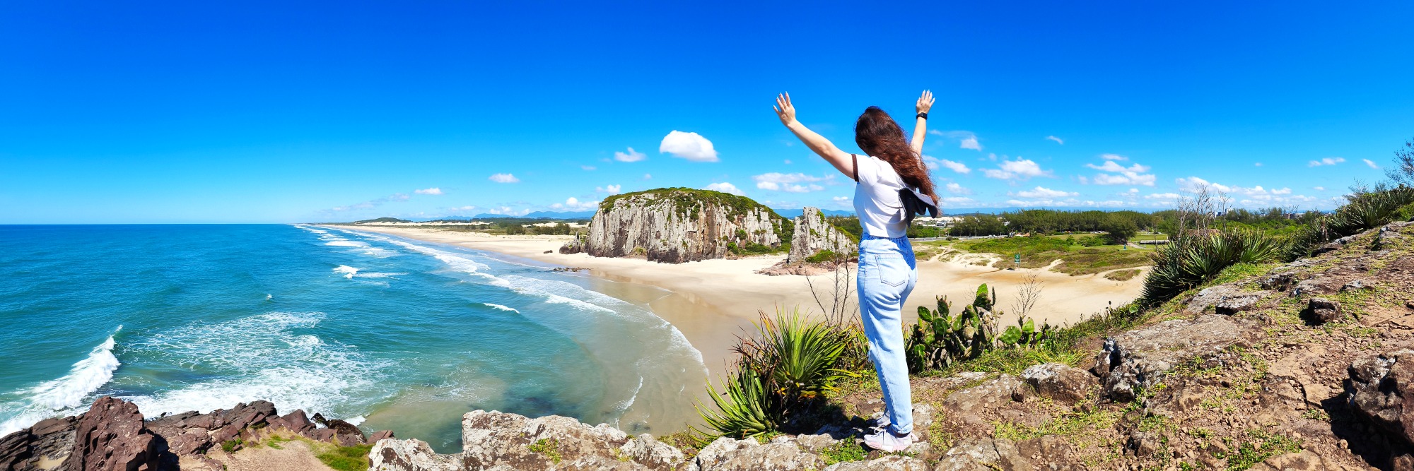
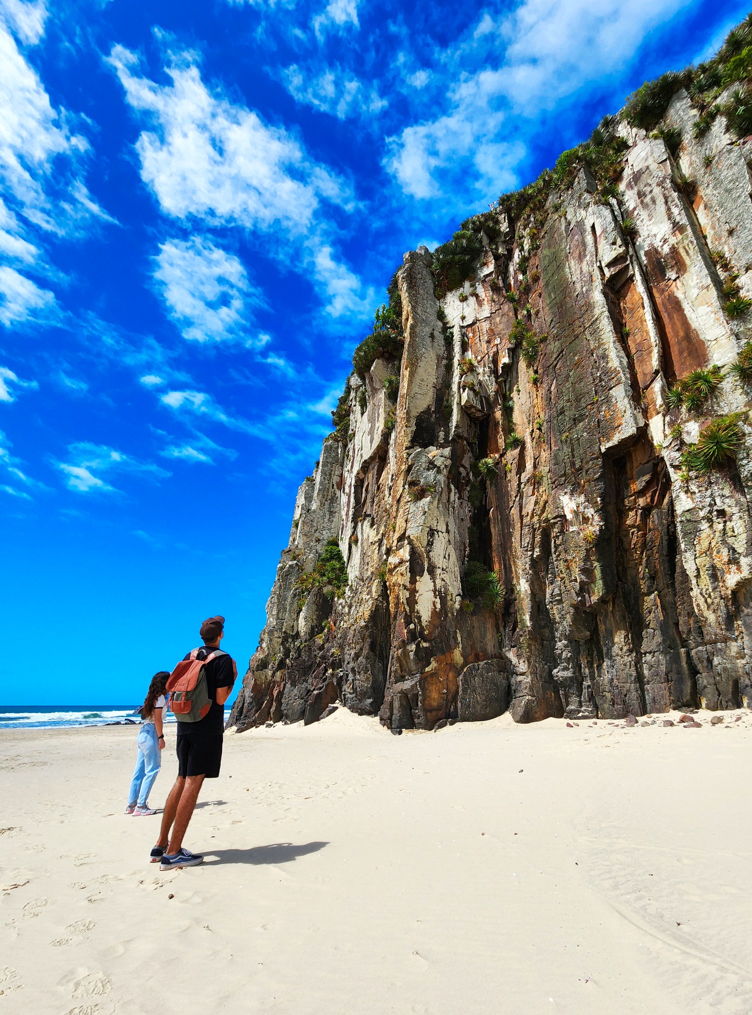
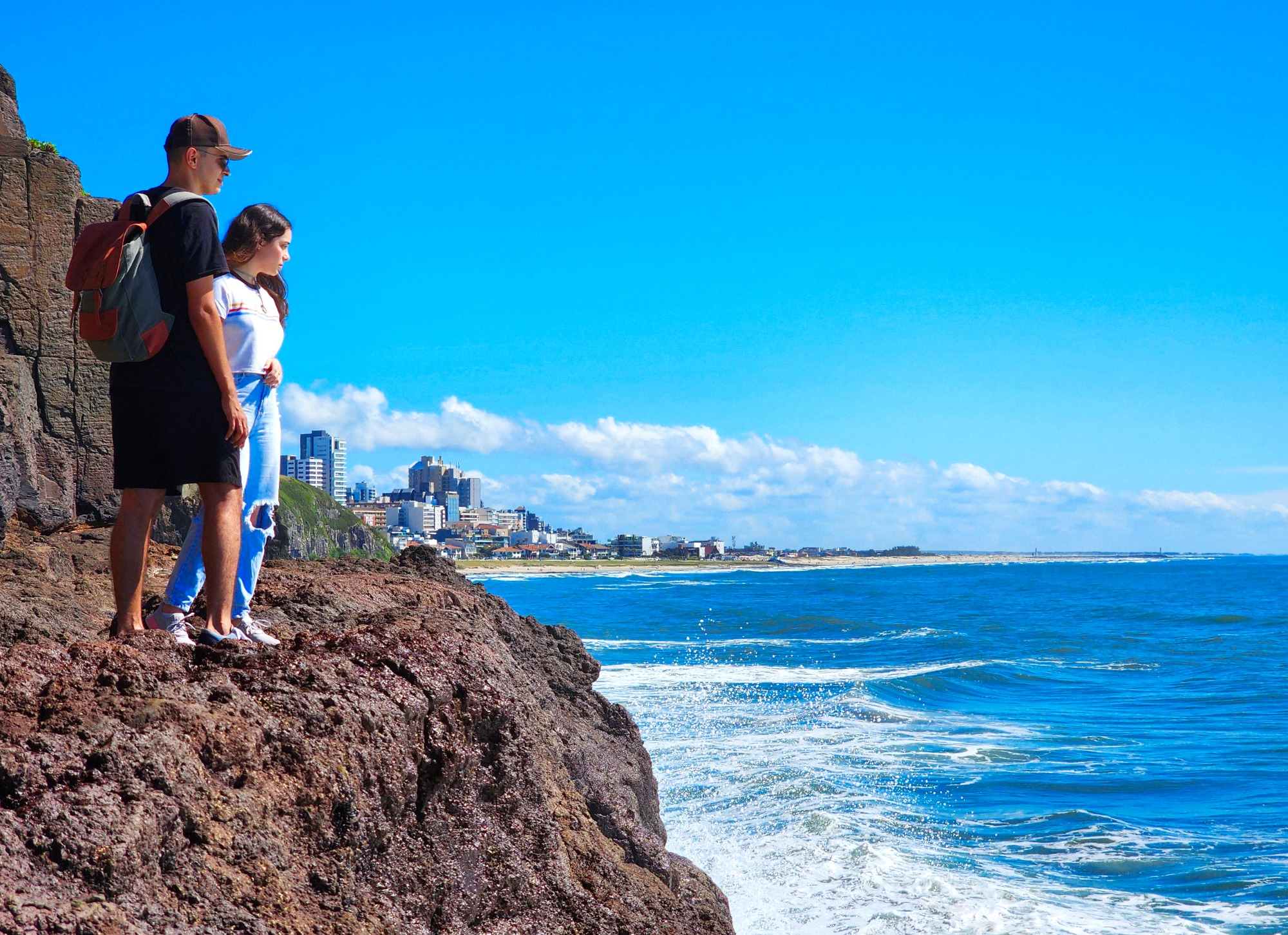
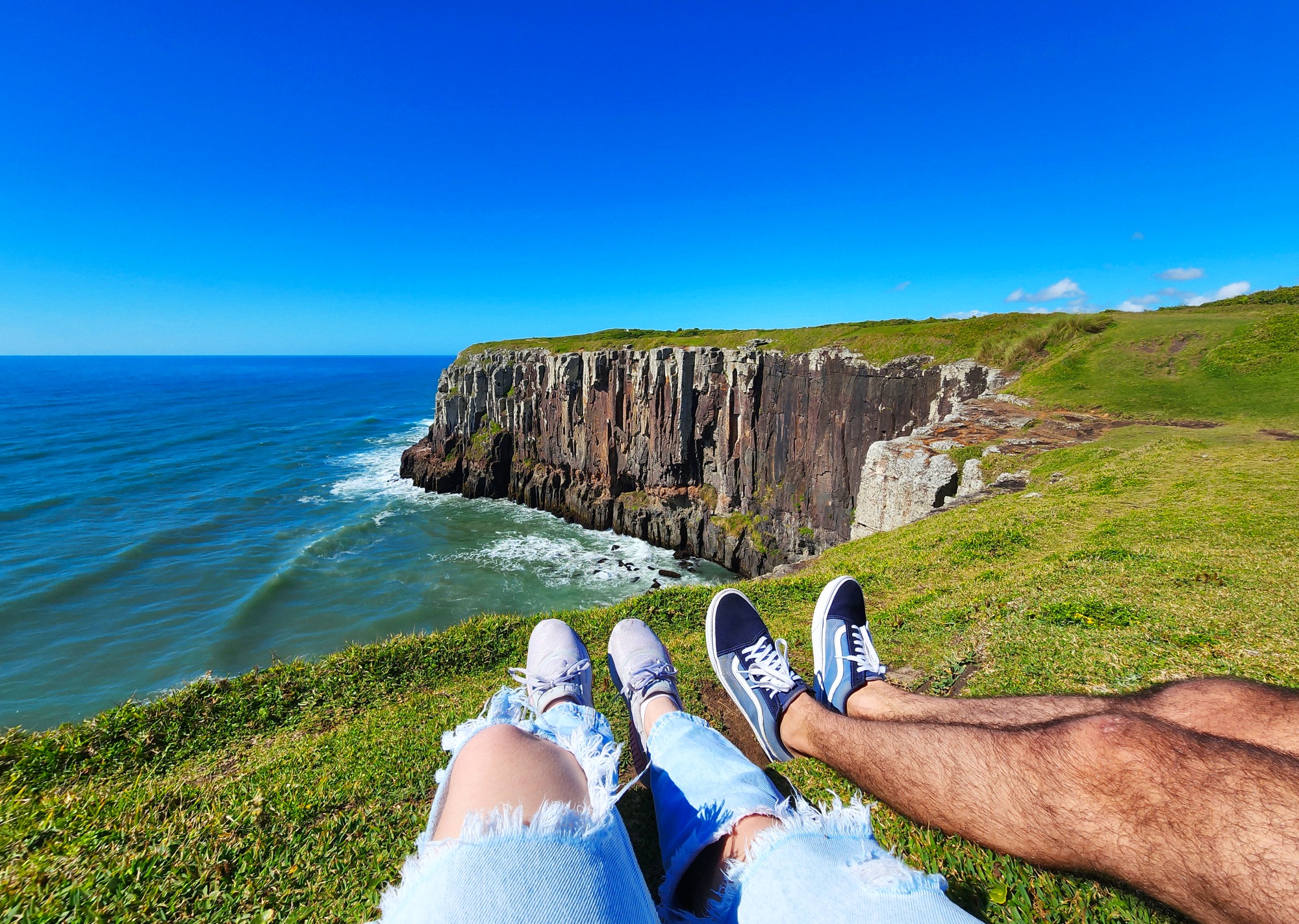
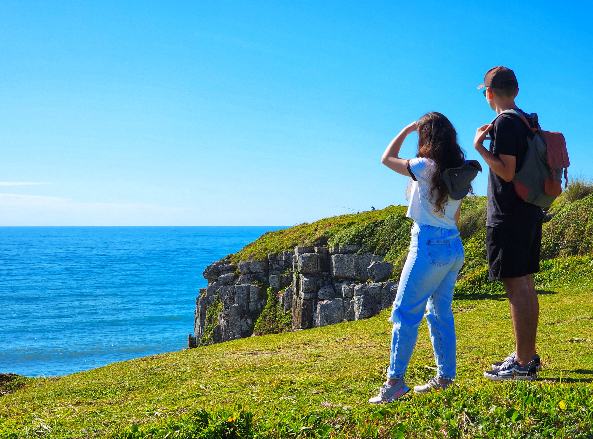
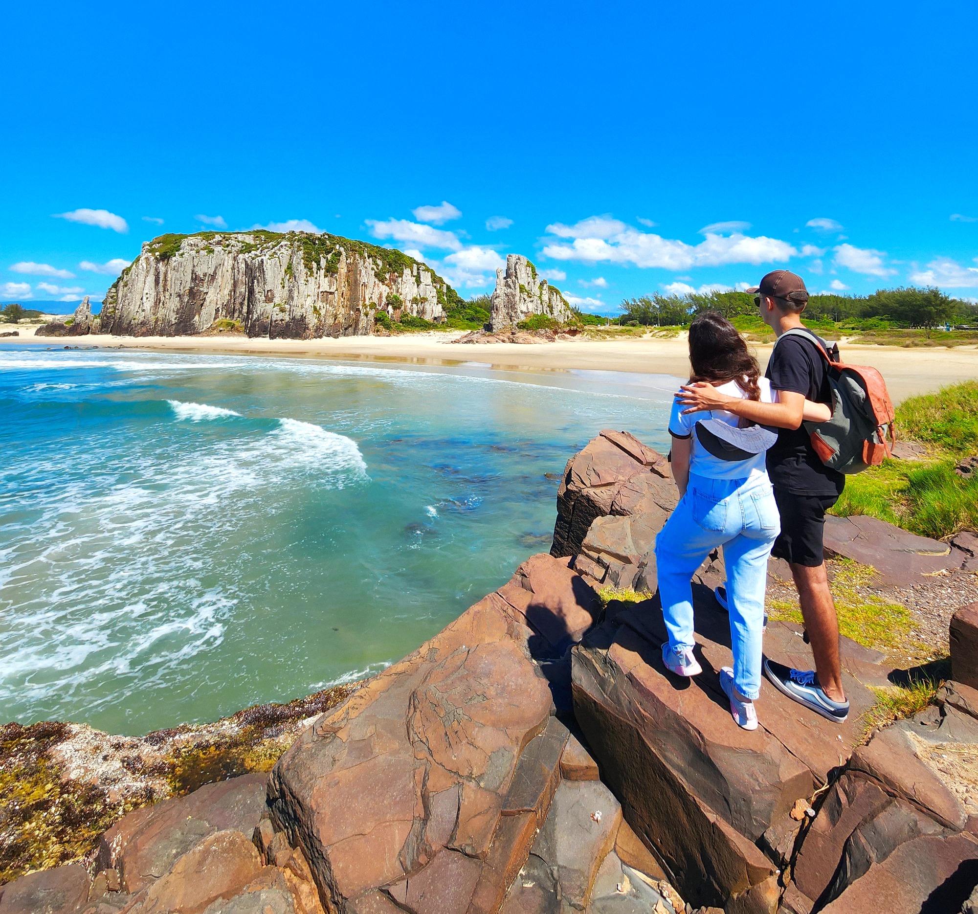
South Tower
Covering more than 1,5 hectares and about 42 m tall, the South Tower offers a beautiful view of the coastline of the city, the center of the city, the Itapeva Park and also the Serra Geral.
Biodiversity in the South Tower
The vegetation on the east face is characterized by low-growing or ground-cover species, whereas on the west face, they reach tree size. Regarding fauna, at the base of the tower we can observe Barnacles (Chthamalus bisinuatus), which are Cirripedia crustaceans, living attached to rocks and also able to live as ectoparasites on whales and turtles; Bivalve mollusks from the Mytilidae family, commonly known as mussels (Brachidontes solisianus; Mytiliaster solisianus; and Perna perna;), Gastropod mollusk bowl snail (Lottia subrugosa), and green algae (Ulva).
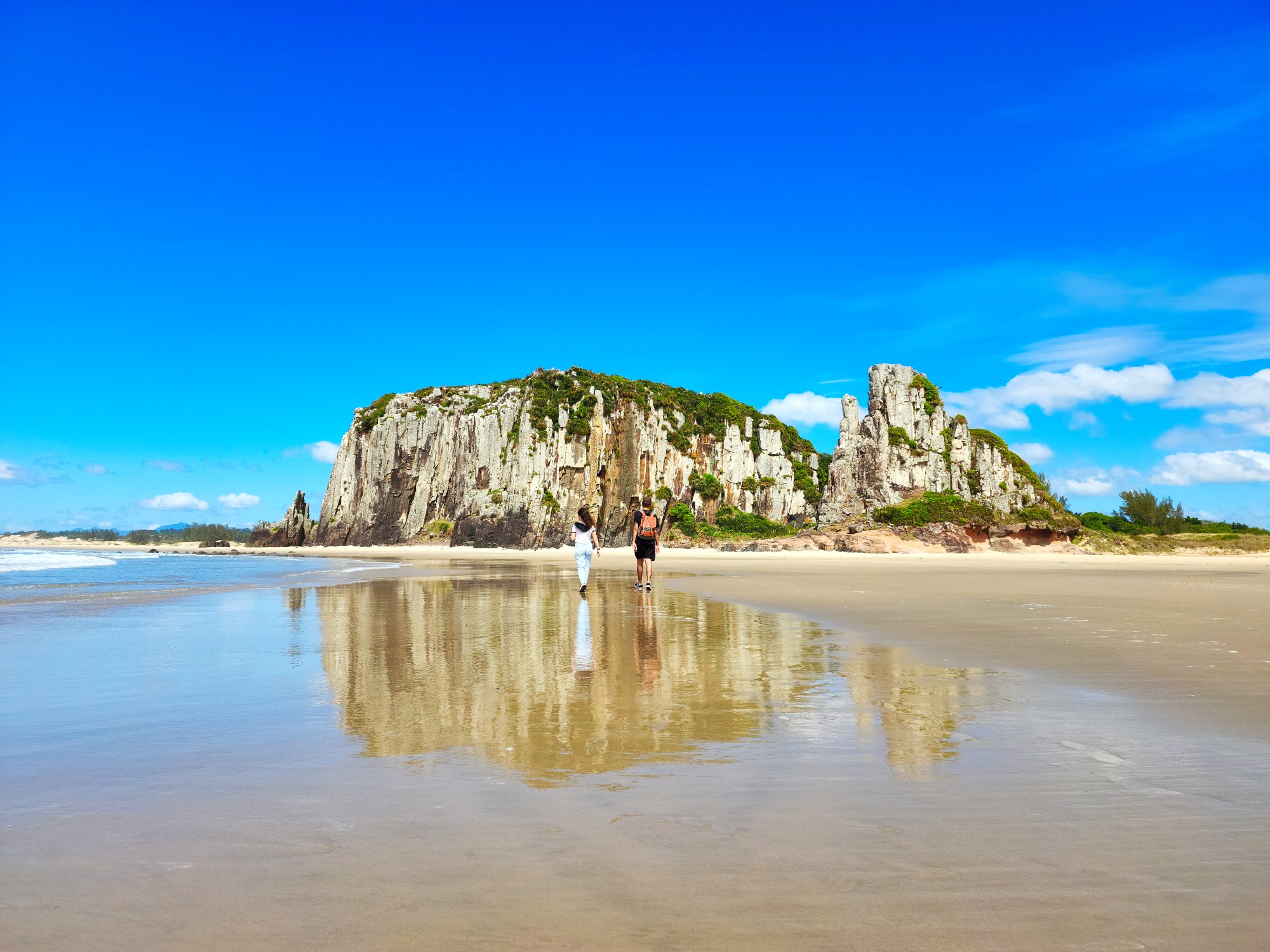
Guarita Tower
Known as Guaritinha or Sentinela, this tower is about 28 meters high and occupies an area of approximately 1,500 m2.
It is part of the collection of geosites of the UNESCO Global Geopark Caminhos dos Cânions do Sul, and is classified as a protected area.
Origins
During the Triassic Period (from 251 to 199 million years ago), the regions corresponding to present-day South America, Africa, Australia, Antarctica, and India were united, forming the megacontinent Gondwana, which gradually began to fragment over time. By the end of the Triassic, during the Jurassic
Period (from 199 to 145 million years ago) and the beginning of the Cretaceous Period (from 145 to 65 million years ago), the Botucatu Desert was formed in Gondwana. This desert covered more than 1 million km2, including a large part of the region that is now the state of Rio Grande do Sul.
Throughout the Cretaceous, several volcanic events of the Tibetan fissural type caused massive lava outpourings that later solidified into basalt, which covered the Botucatu Desert and gave rise to the Serra Geral Formation, including the Aparados da Serra and the towers that gave the city its name.
Mollusks at Guarita
They are invertebrate animals with soft bodies, composed mainly of a foot, visceral mass, and shell (which may be absent, or either internal or external, and can be made of one or two valves). Most species are marina, but there are also many freshwater forms and even terrestrial groups (from humid environments).
The Mollusca Phylum is divided into 8 large groups, although not all of them occur in Brazil, such as: Solenogasters, Aplacophora, Polyplacophora, Monoplacophora, Bivalvia, Scaphopoda, Gastropoda and Cephalopoda.
At Guarita Park, mollusks found mainly belong to the Bivalvia group on the beach and rocks, and to the Gastropoda group in lakes and humid environments.
Why not collect shells?
Mollusk shells are formed primarily of calcium carbonate and are essential to nutrient cycles, playing a key role in forming the skeleton of many marine species, including the mollusks and reef-building corals.
Some animals such as hermit crabs use empty shells for shelter and protection. Others, like marine algae, use shells as a substrate for attachment.
“But it’s just one little shell!” – Said thousands of visitors.
1892 Port
The history of the port in the 19th century
Throughout the 19th century, different projects were developed for the construction of a port in Torres. The provisional president of the Republic, Marshal Manoel Deodoro da Fonseca, on June 19, 1890, entrusted the construction of this port to the United States of Brazil. The concession was made official through Decree No. 1382 of 1891. The soundings and topographic surveys were prepared by a commission led by engineer Luiz Rheingantz.
The Chain
In 1998, rubber pipelines (mangotes) from the Almirante Soares Dutra Maritime Terminal (TEDUT / Petrobras), in Tramandaí, were brought to mark with buoys the presence of a large quantity of submerged rocks and a strong return current (undertow) in that area. The intention was to keep bathers away from that area, thus avoiding accidents and drownings.
In that same winter, strong waves broke the buoy markings, throwing them onto the beach. There was no further interest in replacing them, and because of that, the current became an attraction, creating great insecurity. Only the memory of the chain that anchored near Morro das Furnas remains.
Morro das Furnas and the Legends of Guarita
Morro das Furnas
The Middle Tower, or Morro das Furnas (Furnas Hill), reaches 42 meters in height and covers an area of approximately 10 hectares, making it the largest of the towers in terms of surface area.
On its seaward face, the action of the waves has carved out various cavities in the basalt rock, known as furnas.
The Fairy of Guarita
All around the world, there are several legends tied to this “fairy” phenomenon—and most are quite similar, just changing the location and some details.
According to legend, the fairy seen at Guarita is a slender woman, dressed entirely in white, with long black hair. She appears on certain nights at the top of the Guarita. Up there, she stands still for a long time, gazing out at the horizon—perhaps waiting for a ship to arrive. At times, she becomes restless, moves side to side, and waves, as if she’s seen someone coming.
The Mermaid of the Diamond Cave
Legend has it that every Friday at midnight, a beautiful and seductive mermaid with long silver hair appears at the entrance of the Diamond Cave (Furna do Diamante). If anyone is nearby, the mermaid will ask them for a comb. If the person asks, “What for?”, she will simply say it’s to comb her hair. But if the person gives her the comb without asking anything, while she brushes her hair, she will reveal the location of the hidden treasure of the furnas.
So, if you ever feel brave enough to visit the furnas at midnight on a Friday… don’t forget the comb!
The Gnomes of Guarita
Fishermen say that on moonlit nights at dawn, a small, flamboyantly dressed creature runs along the beach. When it reaches a certain spot near the Guarita, it vanishes—passing straight into the rock.
They say these gnomes guard chests of gold and diamonds hidden by pirates who used to raid Spanish galleons loaded with treasure from Peru in the 17th century.
The Treasure of Guarita
According to legend, two pirates — Jaques and “One-Eye” — stole barrels of gold and other riches from their ship while it was anchored at Ilha dos Lobos, bringing them by rowboat to Guarita Beach.
After burying the treasure, Jaques killed his companion. But when he was pursued and surrounded by the other pirates, he threw himself off the cliff at South Tower, taking the secret of the treasure’s location with him.
Lagoon of Sighs
The so-called Lagoon of Sighs covers an area between 650 and 1,100 m² of wetland, depending on the rainfall, and is located on the eastern side of Morro das Furnas. It appears to be a natural depression in the basalt where rainwater accumulates, with no spring or stream feeding it.
Its name is linked to the lovers who lived around Guarita Beach and used to walk the path leading to the small lagoon (Lagoinha), where they would make promises of eternal love—causing many sighs among the couples.
The lagoon also served as a source of raw material (clay) used to make the original roof tiles of the São Domingos Church, the priest’s house, and the nearby homes. A kiln was built at the northwest base of the Middle Tower (Torre do Meio), located on Cal Beach (Praia da Cal), which became known as the “Pottery Stones” (Pedras da Olaria).
Anuran Amphibians in the Park
Aquatic macrophytes grow in the lagoon, and its surroundings support species asociated with humid environments, such as bromeliads, especially the Gravatá.
Regarding fauna, a highlight is the presence of anuran amphibians (frogs, toads, and tree frogs). According to studies, there are at least 24 species of anurans in Guarita Park, and at least 13 of them occur in the Lagoon of Sighs.
This number is quite significant considering that the Itapeva State Park, which spans almost 1,000 hectares, has a record of 29 anuran species, while Guarita Park covers just around 40 hectares.
The Chapel of the Crucified
Just like the stairways and the casting platforms (used by artisanal fishermen to throw hand lines), the Chapel of the Crucified is part of the infrastructure built in 1957 by SAPT (Society of Friends of Torres Beach) in partnership with SETUR, aimed at the future creation of the park.
This was done through an agreement to carry out the first urbanization works on Lighthouse Tower (Torre do Farol) and Middle Tower (Torre do Meio), creating safe and easy access for visitors—without harming the landscape.
These efforts were passionately directed by Oscar Panitz.
Ilha dos Lobos and Migratory Animals
REVIS Ilha dos Lobos
The Ilha dos Lobos Wildlife Refuge (REVIS) is a federal Conservation Unit (CU) managed by the Chico Mendes Institute for Biodiversity Conservation (ICMBio). It covers 144 hectares, with approximately 3 hectares (depending on sea level) of exposed rocky area, and a buffer zone of 500 meters in all directions. Ilha dos Lobos is the only island along the coast of Rio Grande do Sul.
The rocks that form the island have the same volcanic origin as the other geological formations in the municipality of Torres and the Serra Geral as a whole. They are part of the same outcropping that gave rise to the city (North Tower – Prainha rocks – Ilha dos Lobos). Its visible portion lies about 2.5 km from Guarita Park, with the closest point to the mainland approximately 1.8 km away. Ilha dos Lobos provides shelter for a rich biodiversity of fauna and flora, with a special emphasis on aquatic mammals from the Pinniped group — particularly species from the Otariidae family (fur seals and sea lions) and the Phocidae family (elephant seals and true seals).
Pinnipeds in Torres
The South American sea lion and the South American fur seal are commonly observed on the island, while the elephant seal and true seals are recorded sporadically. The Antarctic fur seal and Subantarctic fur seal have not been recorded on Ilha dos Lobos, but they have been sighted in other areas along the city’s coast.
Migratory Animals
The northern coast of Rio Grande do Sul — especially Torres — is home to a rich and vibrant marine biodiversity, with both resident species (year-round) and migratory species (seasonal).
Among the migratory animals are penguins (Spheniscus magellanicus), which come from the far south of the South American continent, and cetacean mammals (whales and dolphins), with notable appearances from the southern right whale (Eubalaena australis) and the humpback whale (Megaptera novaeangliae). Unlike pinnipeds that come to the region mainly for feeding and resting, whales use the area as a breeding ground.
From Praia Grande to the Mampituba River
Praia Grande and Praia dos Molhes
Praia Grande stretches for 2,200 meters, from Prainha to the banks of the Mampituba River. It features a wide dune belt, notable structures, and historic landmarks such as the first SAPT headquarters (a building constructed in 1936, now known as Bar Abrigo) and the lookout point built in 1952 that originally served as a lifeguard station.
Praia dos Molhes is the final 500-meter stretch of Praia Grande, located next to the breakwaters at the mouth of the Mampituba River. Known as the surfers’ beach, it has a walkway crossing the dune belt in front of Zeca Scheffer Square, where the Torres Surf Memorial Chalet is located.
Mampituba River and the Breakwaters
The Mampituba River serves as a natural boundary between the states of Rio Grande do Sul and Santa Catarina. It originates in the municipality of São Francisco de Paula (RS) at an altitude of 1,050 meters and flows for 90 km until it reaches the Atlantic Ocean, between the cities of Torres (RS) and Passo de Torres (SC).
The mouth of the Mampituba River was protected by a basalt rock structure known as a breakwater, inaugurated on September 8, 1973, which facilitates the entry and exit of fishing boats and fixed the river mouth in place permanently.
The Mampituba River Valley is part of the UNESCO Global Geopark Caminhos dos Cânions do Sul, a region recognized as internationally important due to its geological, biological, and historical-cultural heritage.
Between the Park and Prainha
Furnas Beach / Cal Beach
Initially known as Furnas Beach, until the end of the 1940s there were several kilns used to roast shells, snails, and mollusks to produce lime for masonry mortar and whitewashing. By association, people began referring to the area as “Lime Beach” (Praia da Cal), and that’s how it’s known today. There are still remains of a lime kiln (locally called a “caleira”) near the Portão Bridge. The beach stretches for 800 meters, and at its center by the shore lies the Nossa Senhora dos Navegantes Square.
North Tower
Also known as Morro do Farol (Lighthouse Hill), it rises 46.1 meters high and is the tallest of the towers, considered the best spot on the Rio Grande do Sul coast for observing southern right whales (Eubalaena australis).
Over time, the hill has had different lighthouses:
1912 – Mitchell Tower, a metal structure brought from France
1948 – AGA Tower (Svenska Aktiebolaget Gasaccumulator), metal, manufactured in Sweden
1952 – On May 19, the masonry lighthouse was officially inaugurated (still active today)
1992/93 – Lighthouse equipment was moved to the concrete tower built by the Riograndense Telephone Company
1993 – On September 3, the Southern Nautical Signaling Service installed and tested a new lantern; the old lighthouse light was deactivated.
Prainha or Middle Beach
Prainha is part of the volcanic outcrop where the city originated. It has a rocky bottom, unlike the sandy beaches of the Coastal Plain of Rio Grande do Sul. It has never had dunes, and is covered by grasses that grow over the basalt rocks, just like on the city’s towers.
The shoreline extends for 600 meters, home to the Torres sign, as well as Borges de Medeiros Square and Pinheiro Machado Square, where the city’s first hotel enterprise, Balneário Picoral, was located.
Dunes
The Dunes of Torres
Dunes are natural sandy environments, legally protected, found along the coastal strip or in lower portions of the continent. They may or may not be covered by vegetation and are formed by the action of the wind. They host a biodiversity that is sometimes unique to this ecosystem. In addition to their biological importance, dunes act as protective barriers for the coast against storm surges and prevent the intrusion of saltwater into freshwater environments (lakes and groundwater).
In Torres, the main and largest coastal dune fields are found in the Itapeva State Park and at Praia Grande/Praia dos Molhes. Along the other beaches in the municipality, smaller dune areas also exist. Regarding the so-called inland dunes, the main occurrence is in the Environmental Protection Area of Lagoa de Itapeva. Guarita Park also has a representation of this ecosystem, especially around the bike path and the space between the hills.
Fauna
Dunes serve as shelter and/or feeding grounds for many animal species, some of which are typical of this type of ecosystem. Among the animals, the highlights include: the digger rat(Ctenomys flamarioni), a small burrowing rodent that lives in the sand; the dune lizard (Liolaemus occipitalis), a small reptile threatened with extinction; and the ghost crab (Ocypode quadrata), also known in Brazil as Maria Farinha, which can camouflage in the sand thanks to its coloration.
Flora
Dune vegetation is characterized by species that tolerate poor organic soil, high temperatures, and sea spray. These are halophyte-psammophyte species, meaning they are adapted to high salinity and sandy soils. Some examples include: dune daisy (Senecio crassiflorus), Saltwort (Blutaparon portulacoides), saltgrass (Spartina ciliata), dune grass (Panicum racemosum), Largeleaf pennywort (Hydrocotyle bonariensis), and beach morning glory (Ipomoea pes-caprae).
Dunes in Guarita Park
The region of Guarita Park and its surrounding area once had a relatively extensive dune field. Over time and with urban development, much of this off-park environment was occupied. Today, coastal dunes of less than 1 hectare remain, located mainly between the South Tower and the Middle Tower. Around the park’s bike path, there is an inland dune field that occupies approximately 6 hectares.
The characteristics of inland dunes—such as those near the bike path—are linked to events of shoreline transgression (advance) and regression (retreat) that occurred over time. Coastal dunes, also known as frontal dunes, are formed by the dynamic interaction between sandy sediments and coastal winds.
Vegetation
Vegetation in Torres
The region of Torres is part of the Atlantic Forest biome, with its predominant vegetation classified as Dense Ombrophilous Forest (according to IBGE/RADAM BRASIL). This forest formation is considered the most endangered both regionally and nationally. The most predominant botanical groups in the region include the families: Lauraceae, Myrtaceae, and Annonaceae, with good diversity also in Bromeliaceae and Orchidaceae.
The vegetation formations can be grouped into two main categories: Herbaceous Formations (Psammophilous Vegetation and Halophytic Vegetation) dominate the coastal zone, while Forest Formations (Sandy Forests, Swamp Forests, and Hilltop Forests) are more typical of the inland areas, still present in the Itapeva State Park and to a lesser extent in the Guarita Park.
Vegetation in Guarita Park
The park features a mix of native and exotic species and can be divided into six sections:
- On the east face of the Middle and South Towers, due to marine influence, salinity, and constant winds, low and/or shrub-sized species predominate.
- On the west face of the hills, relatively protected by rock walls, species grow taller, including woody tree specimens.
- In the sandy strip between the Middle and South Towers, as well as around the bike path, species are adapted to sandy and saline conditions.
- In the southwestern zone of the park, between the parking lot and Alfiero Zanardi Street, there is a more significant fragment of native forest in terms of size and diversity.
- In the northwestern area, a wetland and its associated flora dominate.
- In the artificial lakes and in the Lagoa dos Suspiros, aquatic macrophytes are found, especially from the families Poaceae (grasses) and Cyperaceae (sedges).
Among native tree and shrub species, the highlights include Myrtaceae (myrtles), Fabaceae (legumes), Anacardiaceae (cashews), Euphorbiaceae, Malvaceae (mallows), Melastomataceae, and Verbenaceae. Among the exotic species—mainly in the parking area—the Australian Pine (Casuarina equisetifolia) stands out, used for dune stabilization and part of the park’s visual identity since its early days.
Birds
Bird, songbird or Dinosaur?
From an evolutionary standpoint, birds are considered dinosaurs. They descend from the theropod lineage and share ancestry with the Dromaeosauridae family, which includes the velociraptors. The Archaeopteryx is viewed as an evolutionary link between birds and reptiles.
The term “bird” is used for vertebrate animals whose bodies are covered in feathers and whose forelimbs are modified into wings—although not all birds are capable of flight. Within the bird group, there’s a suborder called Passeriformes (perching songbirds), which are usually small in size, have four toes on the same level, and exhibit a wide variety of songs.
So, all songbirds are birds, but not all birds are songbirds. The same logic applies to dinosaurs: every bird (including songbirds) is a dinosaur, but not every dinosaur is a bird.
Birds in Guarita
The fauna in Torres falls mainly within the Atlantic Forest zoogeographic region and, like its flora, is highly diverse and varies according to the different ecosystems. Among the animals, one of the most prominent groups is the birds, with many species occurring in the Guarita Park. The park’s environmental variety supports a rich bird population, with over 100 recorded species, including both resident and migratory birds.
APA of Lagoa de Itapeva
Origin of the APA of Lagoa de Itapeva
The Environmental Protection Area of Lagoa de Itapeva (APALI) is a municipal Conservation Unit located in Torres. It was created as a compensatory measure for the construction of the North Coast Regional Airport on 12/07/1999, through Municipal Law 3.372/1999. It encompasses a segment of 436.99 hectares of land located between the Airport and Lagoa de Itapeva (the lagoon itself is not part of the APA).
Environments and Geology
APALI is a segment of restinga (sandy ridges parallel to the coastline), formed by ancient wind-blown deposits (paleodunes), originating from marine transgressions (advances) and regressions (retreats) that occurred during the Holocene period (representing the last 11,000 years of Earth’s history), which marked the last glaciation period — the Ice Age.
The paleodunes, also called Barrier Systems, isolated bodies of water formed when the sea reached its maximum level at the end of the transgressive event, giving rise to the chain of coastal lagoons that exist today along our coastal plain.
The different environments within the APA can be grouped into three categories:
Wetland / Marsh / Swamp Forest:
This set of environments is located in the easternmost part of the area, combining open fields, wetter areas, and fragments of Swamp Forest — a forest type characterized by highly waterlogged soil.
Psammophilous Vegetation / Restinga / Swamp Forest:
This is the middle portion of the unit, where dunes up to 30 meters above sea level are prominent. In some locations, Swamp Forest is also present, but the soil is predominantly sandy, and the vegetation is adapted to these conditions.
Wet Field / Limnophilous Vegetation:
This portion of the APA lies on the western side, reaching the shores of Lagoa de Itapeva. It is characterized by moist soil, sometimes exposed and sometimes covered by water (depending on the lagoon’s level), and vegetation adapted to these conditions.
Importance of APALI
The Environmental Protection Area of Lagoa de Itapeva is one of four Conservation Units in the municipality of Torres, on the north coast of Rio Grande do Sul. The others are: the Ilha dos Lobos Wildlife Refuge (ICMBIO), the Itapeva State Park (SEMA-RS), and the RPPN Recanto do Robalo (private).
The Lagoa de Itapeva APA is also located within the buffer zone of the Itapeva State Park and in the ecological corridor that connects Lagoa de Itapeva to Lagoa do Jacaré, making it an important area for preserving regional biodiversity.
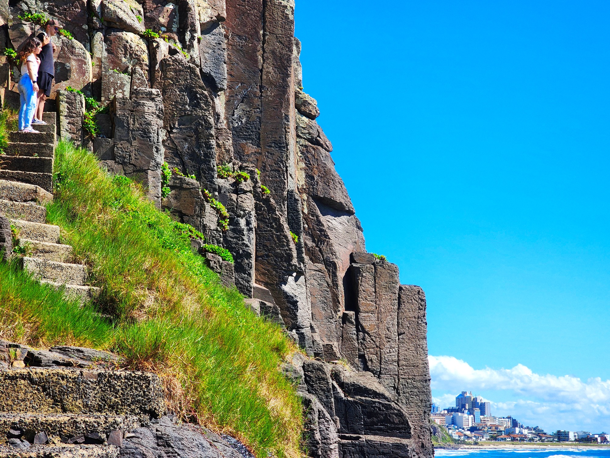
The Towers of Torres
Origins
During the Triassic Period (from 251 to 199 million years ago), the regions corresponding to present-day South America, Africa, Australia, Antarctica, and India were united, forming the megacontinent Gondwana, which gradually began to fragment over time. By the end of the Triassic, during the Jurassic Period (from 199 to 145 million years ago) and the beginning of the Cretaceous Period (from 145 to 65 million years ago), the Botucatu Desert was formed in Gondwana. This desert covered more than 1 million km2, including a large part of the region that is now the state of Rio Grande do Sul.
Throughout the Cretaceous, several volcanic events of the Tibetan fissural type caused massive lava outpourings that later solidified into basalt, which covered the Botucatu Desert and gave rise to the Serra Geral Formation, including the Aparados da Serra and the towers that gave the city its name.
South Tower
It is about 42 meters high and is the second tallest, occupying a little more than 1.5 hectares, with a beautiful 360° view.
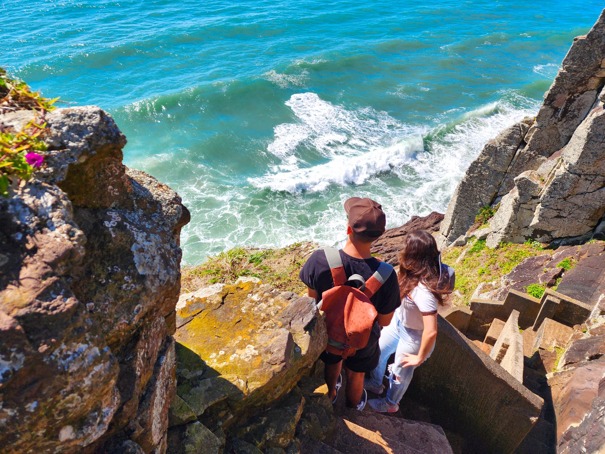
Access to the top is via a staircase with 124 steps.
North Tower or Lighthouse Hill
Among the largest towers, it is the only one located outside the park and is also known as Lighthouse Hill. At 46.1 meters, it is the tallest of the towers and is considered the best vantage point for observing the southern right whale (Eubalaena australis) along the southern coast of Brazil.
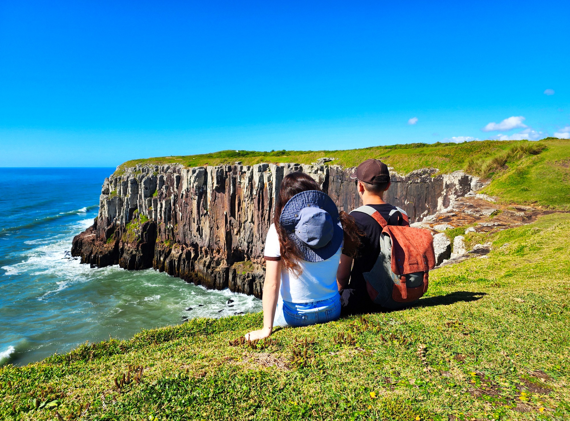
Middle Tower or Furnas Hill
It reaches almost 42 meters in height and occupies an area of approximately 10 hectares, making it the largest tower in terms of area. On its ocean-facing side, wave action has carved out different cavities in the basalt (furnas). These include: Salitinho, Tesão, Alto do Tesão, Paredão, Furna do Forte, Furna Secreta, Portão, and Sentinela.
Ilha dos Lobos (Wolves’ Island)
The rocks that make up the island have the same volcanic origin as the other towers in the municipality of Torres and the Serra Geral as a whole. They are part of the outcrop that gave rise to the city (North Tower – Prainha rocks – Ilha dos Lobos). The visible portion of the island lies about 2.5 km from Guarita Park, and its closest point to the coast is approximately 1.8 km away.
Guarita or Sentinela (Sentinel)
Known as Guarita or Sentinela, this tower is about 28 meters high and occupies an area of nearly 1,500 m². Its base is composed of Jurassic-aged sandstone from the Botucatu Desert, topped by Cretaceous-aged basalt from the Serra Geral Formation.
Taking care of the park
- Respect dangerous areas, risk of falling. Climbing Guarita hill is prohibited.
- Radical sports only with authorization.
- Take only pictures and good memories.
- Camping is prohibited.
- No sound speakers or loud music.
- Don’t draw or write on the boulders.
- Animals have to be on a leash.
- Respect local fauna and flora.
- Keep the park clean.
- Campfires and barbecues are prohibited.
- Don’t take animals to the sand.
- No fishing with fishnets.
Itapeva State Park
The Parque Estadual da Itapeva (Itapeva State Park), with 998,06 hectares, aims to protect ecosystems and species of fauna and flora that are rare or threatened, and promoting research activities, environmental education and ecotourism. It houses environments such as dunes, restinga vegetation, dry and flooded fields, peat bogs, and Paludosa Forrest (formed on very moist soils). The park plays an important role in preserving one of the last remaining landscapes of the state’s coastal plain.
Visit the park’s website at sema.rs.gov.br/itapeva

Telefones
Transparência
Informações
- Horários de atendimento:
Segundas:
das 8h às 11h30
das 13h às 19hTerças a Sextas:
das 13h às 19h -
R. José Antônio Picoral, 79
Centro
CEP: 95560-000
Guarita State Park
Creation of the Park
José Lutzenberger State Park
Special Area of Tourist Interest
- Approximately 40 hectares of park area
- More than 100 bird species
- 21 species of anuran amphibians
- Contains three of the seven natural towers that gave the municipality its name
The Father of Guarita
José Antônio Lutzenberger (Dec 17, 1926 – May 14, 2002)
An agronomist from Porto Alegre (RS), specialized in soil science. José Antônio Lutzenberger is one of the key names in the global environmental movement. A promoter of sustainable development and environmental awareness, he received the Right Livelihood Award (also known as the “Alternative Nobel Prize”) and founded the Gaia Foundation (fgaia.com.br).
The initial landscaping project for the Guarita Park included the participation of the team of the renowned São Paulo artist Roberto Burle Marx (Aug 4, 1909 – Jun 4, 1992). However, since the proposal had a more urbanistic focus, the project was not carried forward. From that point on, Lutzenberger began developing a landscaping plan centered more on environmental aspects.
Park History
The main legal actions for the expropriation of the seaside towers occurred between 1956 and 1968. Under the administration of the State Department of Tourism and with the participation of José Lutzenberger, Guarita Park began to take shape from 1971 onward. Here are the key milestones:
Dec 28, 1971
The area is declared of public interest (State Decree 21.540/1971) for the creation of Guarita Park, with José Lutzenberger as its main visionary.
Oct 14, 1981
The site becomes a Special Area of Tourist Interest (State Decree 30.377/1981) with an area of over 1,000 hectares, including parts of what now belongs to Itapeva State Park.
Sept 9, 1983
Guarita Park has its area reduced to its current size, with just over 40 hectares. A large portion of the previous area became part of Itapeva Park in 2002, and another portion was urbanized, becoming the Guarita/Arroio neighborhood.
1996 to 2002
The park’s management shifted between the State Department of Tourism and, at times, the local City Hall. In 2003, the State officially handed over the park’s administration to the municipality.
Jan 2, 2003
The park is officially renamed José Lutzenberger State Park, in honor of the renowned environmentalist.
UNESCO’s Global Geopark
Caminhos do Cânions do Sul – Territory
Reknown as UNESCO Global Geopark in 2021.
- The geopark is an iniciative aimed at sustainable economic development, having as base the integration and the valorization of natural and cultural heritage of a region.
- Territory: 2.830 Km2
- Member cities:
- RS: Torres, Mampituba and Cambará do Sul.
- SC: Praia Grande, Jacinto Machado, Timbé do Sul and Morro Grande.
Visit the website on canionsdosul.org
Beaches
Praia de Fora
The Praia de Fora with 325,17 m of extension, is one of the smaller beaches of the city. Situated in between the South Tower and Itapeva Beach, it’s the beach more at north of the ones called beaches of the south, in Torres’ coastline. This beach is a great option for people who want a quieter place to swim, but still close to the urban center. In the vicinity of Praia de Fora, there are 3 great natural environments, the Restinga, the Dunes and the Paludosa Forrest.
Other beaches from Torres
From the north limit with the Molhes of the Mampituba River (border with Passo de Torres-SC), until the extreme south (border with Arroio do Sal), the city of Torres have 24 beaches, being the smallest the Beach of Caqueiros (62,75 m) and the biggest the Itapeva Beach (3.828,63 m).
From the Beach of the Molhes to the South Tower, are the beaches that informally make the municipal north coast, characterized for the visual variation, with sandy beaches interspersed with rocky/grassy beaches and hills; and from the South Tower to the Paraíso Beach, we have the municipal south coast, characterized essentially for sandy beaches with homogeneous appearance, except in Itapeva Beach, with the Itapeva Boulder, and in Lagoa Jardim Beach, with the Caracol Monument (a dune in a spiral shape).
South Tower
Covering more than 1,5 hectares and about 42 m tall, the South Tower offers a beautiful view of the coastline of the city, the center of the city, the Itapeva Park and also the Serra Geral.
Biodiversity in the South Tower
The vegetation on the east face is characterized by low-growing or ground-cover species, whereas on the west face, they reach tree size. Regarding fauna, at the base of the tower we can observe Barnacles (Chthamalus bisinuatus), which are Cirripedia crustaceans, living attached to rocks and also able to live as ectoparasites on whales and turtles; Bivalve mollusks from the Mytilidae family, commonly known as mussels (Brachidontes solisianus; Mytiliaster solisianus; and Perna perna;), Gastropod mollusk bowl snail (Lottia subrugosa), and green algae (Ulva).
Guarita Tower
Known as Guaritinha or Sentinela, this tower is about 28 meters high and occupies an area of approximately 1,500 m2.
It is part of the collection of geosites of the UNESCO Global Geopark Caminhos dos Cânions do Sul, and is classified as a protected area.
Origins
During the Triassic Period (from 251 to 199 million years ago), the regions corresponding to present-day South America, Africa, Australia, Antarctica, and India were united, forming the megacontinent Gondwana, which gradually began to fragment over time. By the end of the Triassic, during the Jurassic
Period (from 199 to 145 million years ago) and the beginning of the Cretaceous Period (from 145 to 65 million years ago), the Botucatu Desert was formed in Gondwana. This desert covered more than 1 million km2, including a large part of the region that is now the state of Rio Grande do Sul.
Throughout the Cretaceous, several volcanic events of the Tibetan fissural type caused massive lava outpourings that later solidified into basalt, which covered the Botucatu Desert and gave rise to the Serra Geral Formation, including the Aparados da Serra and the towers that gave the city its name.
Mollusks at Guarita
They are invertebrate animals with soft bodies, composed mainly of a foot, visceral mass, and shell (which may be absent, or either internal or external, and can be made of one or two valves). Most species are marina, but there are also many freshwater forms and even terrestrial groups (from humid environments).
The Mollusca Phylum is divided into 8 large groups, although not all of them occur in Brazil, such as: Solenogasters, Aplacophora, Polyplacophora, Monoplacophora, Bivalvia, Scaphopoda, Gastropoda and Cephalopoda.
At Guarita Park, mollusks found mainly belong to the Bivalvia group on the beach and rocks, and to the Gastropoda group in lakes and humid environments.
Why not collect shells?
Mollusk shells are formed primarily of calcium carbonate and are essential to nutrient cycles, playing a key role in forming the skeleton of many marine species, including the mollusks and reef-building corals.
Some animals such as hermit crabs use empty shells for shelter and protection. Others, like marine algae, use shells as a substrate for attachment.
“But it’s just one little shell!” – Said thousands of visitors.
1892 Port
The history of the port in the 19th century
Throughout the 19th century, different projects were developed for the construction of a port in Torres. The provisional president of the Republic, Marshal Manoel Deodoro da Fonseca, on June 19, 1890, entrusted the construction of this port to the United States of Brazil. The concession was made official through Decree No. 1382 of 1891. The soundings and topographic surveys were prepared by a commission led by engineer Luiz Rheingantz.
The Chain
In 1998, rubber pipelines (mangotes) from the Almirante Soares Dutra Maritime Terminal (TEDUT / Petrobras), in Tramandaí, were brought to mark with buoys the presence of a large quantity of submerged rocks and a strong return current (undertow) in that area. The intention was to keep bathers away from that area, thus avoiding accidents and drownings.
In that same winter, strong waves broke the buoy markings, throwing them onto the beach. There was no further interest in replacing them, and because of that, the current became an attraction, creating great insecurity. Only the memory of the chain that anchored near Morro das Furnas remains.
Morro das Furnas and the Legends of Guarita
Morro das Furnas
The Middle Tower, or Morro das Furnas (Furnas Hill), reaches 42 meters in height and covers an area of approximately 10 hectares, making it the largest of the towers in terms of surface area.
On its seaward face, the action of the waves has carved out various cavities in the basalt rock, known as furnas.
The Fairy of Guarita
All around the world, there are several legends tied to this “fairy” phenomenon—and most are quite similar, just changing the location and some details.
According to legend, the fairy seen at Guarita is a slender woman, dressed entirely in white, with long black hair. She appears on certain nights at the top of the Guarita. Up there, she stands still for a long time, gazing out at the horizon—perhaps waiting for a ship to arrive. At times, she becomes restless, moves side to side, and waves, as if she’s seen someone coming.
The Mermaid of the Diamond Cave
Legend has it that every Friday at midnight, a beautiful and seductive mermaid with long silver hair appears at the entrance of the Diamond Cave (Furna do Diamante). If anyone is nearby, the mermaid will ask them for a comb. If the person asks, “What for?”, she will simply say it’s to comb her hair. But if the person gives her the comb without asking anything, while she brushes her hair, she will reveal the location of the hidden treasure of the furnas.
So, if you ever feel brave enough to visit the furnas at midnight on a Friday… don’t forget the comb!
The Gnomes of Guarita
Fishermen say that on moonlit nights at dawn, a small, flamboyantly dressed creature runs along the beach. When it reaches a certain spot near the Guarita, it vanishes—passing straight into the rock.
They say these gnomes guard chests of gold and diamonds hidden by pirates who used to raid Spanish galleons loaded with treasure from Peru in the 17th century.
The Treasure of Guarita
According to legend, two pirates — Jaques and “One-Eye” — stole barrels of gold and other riches from their ship while it was anchored at Ilha dos Lobos, bringing them by rowboat to Guarita Beach.
After burying the treasure, Jaques killed his companion. But when he was pursued and surrounded by the other pirates, he threw himself off the cliff at South Tower, taking the secret of the treasure’s location with him.
Lagoon of Sighs
The so-called Lagoon of Sighs covers an area between 650 and 1,100 m² of wetland, depending on the rainfall, and is located on the eastern side of Morro das Furnas. It appears to be a natural depression in the basalt where rainwater accumulates, with no spring or stream feeding it.
Its name is linked to the lovers who lived around Guarita Beach and used to walk the path leading to the small lagoon (Lagoinha), where they would make promises of eternal love—causing many sighs among the couples.
The lagoon also served as a source of raw material (clay) used to make the original roof tiles of the São Domingos Church, the priest’s house, and the nearby homes. A kiln was built at the northwest base of the Middle Tower (Torre do Meio), located on Cal Beach (Praia da Cal), which became known as the “Pottery Stones” (Pedras da Olaria).
Anuran Amphibians in the Park
Aquatic macrophytes grow in the lagoon, and its surroundings support species asociated with humid environments, such as bromeliads, especially the Gravatá.
Regarding fauna, a highlight is the presence of anuran amphibians (frogs, toads, and tree frogs). According to studies, there are at least 24 species of anurans in Guarita Park, and at least 13 of them occur in the Lagoon of Sighs.
This number is quite significant considering that the Itapeva State Park, which spans almost 1,000 hectares, has a record of 29 anuran species, while Guarita Park covers just around 40 hectares.
The Chapel of the Crucified
Just like the stairways and the casting platforms (used by artisanal fishermen to throw hand lines), the Chapel of the Crucified is part of the infrastructure built in 1957 by SAPT (Society of Friends of Torres Beach) in partnership with SETUR, aimed at the future creation of the park.
This was done through an agreement to carry out the first urbanization works on Lighthouse Tower (Torre do Farol) and Middle Tower (Torre do Meio), creating safe and easy access for visitors—without harming the landscape.
These efforts were passionately directed by Oscar Panitz.
Ilha dos Lobos and Migratory Animals
REVIS Ilha dos Lobos
The Ilha dos Lobos Wildlife Refuge (REVIS) is a federal Conservation Unit (CU) managed by the Chico Mendes Institute for Biodiversity Conservation (ICMBio). It covers 144 hectares, with approximately 3 hectares (depending on sea level) of exposed rocky area, and a buffer zone of 500 meters in all directions. Ilha dos Lobos is the only island along the coast of Rio Grande do Sul.
The rocks that form the island have the same volcanic origin as the other geological formations in the municipality of Torres and the Serra Geral as a whole. They are part of the same outcropping that gave rise to the city (North Tower – Prainha rocks – Ilha dos Lobos). Its visible portion lies about 2.5 km from Guarita Park, with the closest point to the mainland approximately 1.8 km away. Ilha dos Lobos provides shelter for a rich biodiversity of fauna and flora, with a special emphasis on aquatic mammals from the Pinniped group — particularly species from the Otariidae family (fur seals and sea lions) and the Phocidae family (elephant seals and true seals).
Pinnipeds in Torres
The South American sea lion and the South American fur seal are commonly observed on the island, while the elephant seal and true seals are recorded sporadically. The Antarctic fur seal and Subantarctic fur seal have not been recorded on Ilha dos Lobos, but they have been sighted in other areas along the city’s coast.
Migratory Animals
The northern coast of Rio Grande do Sul — especially Torres — is home to a rich and vibrant marine biodiversity, with both resident species (year-round) and migratory species (seasonal).
Among the migratory animals are penguins (Spheniscus magellanicus), which come from the far south of the South American continent, and cetacean mammals (whales and dolphins), with notable appearances from the southern right whale (Eubalaena australis) and the humpback whale (Megaptera novaeangliae). Unlike pinnipeds that come to the region mainly for feeding and resting, whales use the area as a breeding ground.
Itapeva State Park
Itapeva State Park
The Parque Estadual da Itapeva (Itapeva State Park), with 998,06 hectares, aims to protect ecosystems and species of fauna and flora that are rare or threatened, and promoting research activities, environmental education and ecotourism. It houses environments such as dunes, restinga vegetation, dry and flooded fields, peat bogs, and Paludosa Forrest (formed on very moist soils). The park plays an important role in preserving one of the last remaining landscapes of the state’s coastal plain.
Visit the park’s website at sema.rs.gov.br/itapeva
Telefones
Transparência
Informações
- Horários de atendimento:
Segundas:
das 8h às 11h30
das 13h às 19hTerças a Sextas:
das 13h às 19h -
R. José Antônio Picoral, 79
Centro
CEP: 95560-000